-
by pltm

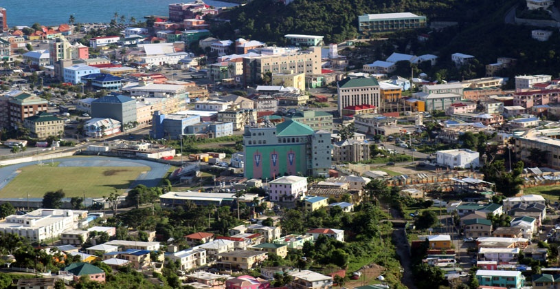
(PLTM) - In order to mitigate flood risks, new policies are being implemented and the building codes will be amended to put measures in place to reduce flooding.
This follows the completion of a Hydrology and Flood Risk Analysis, which saw the development of a policy to guide the development of infrastructure in flood-prone areas.
The study was aimed at understanding the flood risk in Road Town, and as part of that study preliminary structural design models to feed into reducing flood risk were created.
Director of the Department of Disaster Management (DDM), Ms. Sharleen DaBreo disclosed, “We have already integrated the model into the Hazard Vulnerability Assessment Process.”
“What that means is that if you are developing your parcel of land,” she explained, “there is a requirement now through the Town and Country Planning Department."
DaBreo said that persons can submit their parcel to DDM, whether it’s a requirement from Planning, "or just you wanting to make sure that you understand the risk to your parcel and it gives you specific recommendations that you would need to incorporate from the design stage or actually from the sub-division stage all the way through to construction.”
She revealed that thus far, 42 such reports have been generated for 42 sites that are going to be restored.
Project Manager of the study, Dr. Nick Jarritt, whose team formulated the policy, explained that they looked at “how to ensure that future developments don’t increase flood risks or occur in areas that are going to be unsafe.”
Part of that included the examination of existing planning regulation, as well as an assessment of the drainage systems around Road Town.
“What we find across all of the ghuts in Road Town, is that for most of their length, they are big enough and they are constructed in ways that will convey a huge amount of water and deal with a lot of flooding problems...but we hit specific points where that capacity gets reduced,” Dr. Jarritt stated.
The recommendation, he said, is to have these pinch points expanded to allow the free flow of water.
They also looked at critical areas around Road Town that are usually subjected to flooding.
“So that’s looking at the lower reaches of Long Bush and Huntum’s Ghut, the areas around Supa Value, the fire station and cinema and the ghuts around that area….Looking at Johnson’s Ghut and the drainage in Purcell…And finally some adjustment and some changes around the back of Main Street," he explained.